MadridCycleTrack is an initiative launched by the tGIS Research Group of the Complutense University of Madrid, with the following objectives:
- To collect routes from casual cyclists and bike-messengers, especially GPS routes.
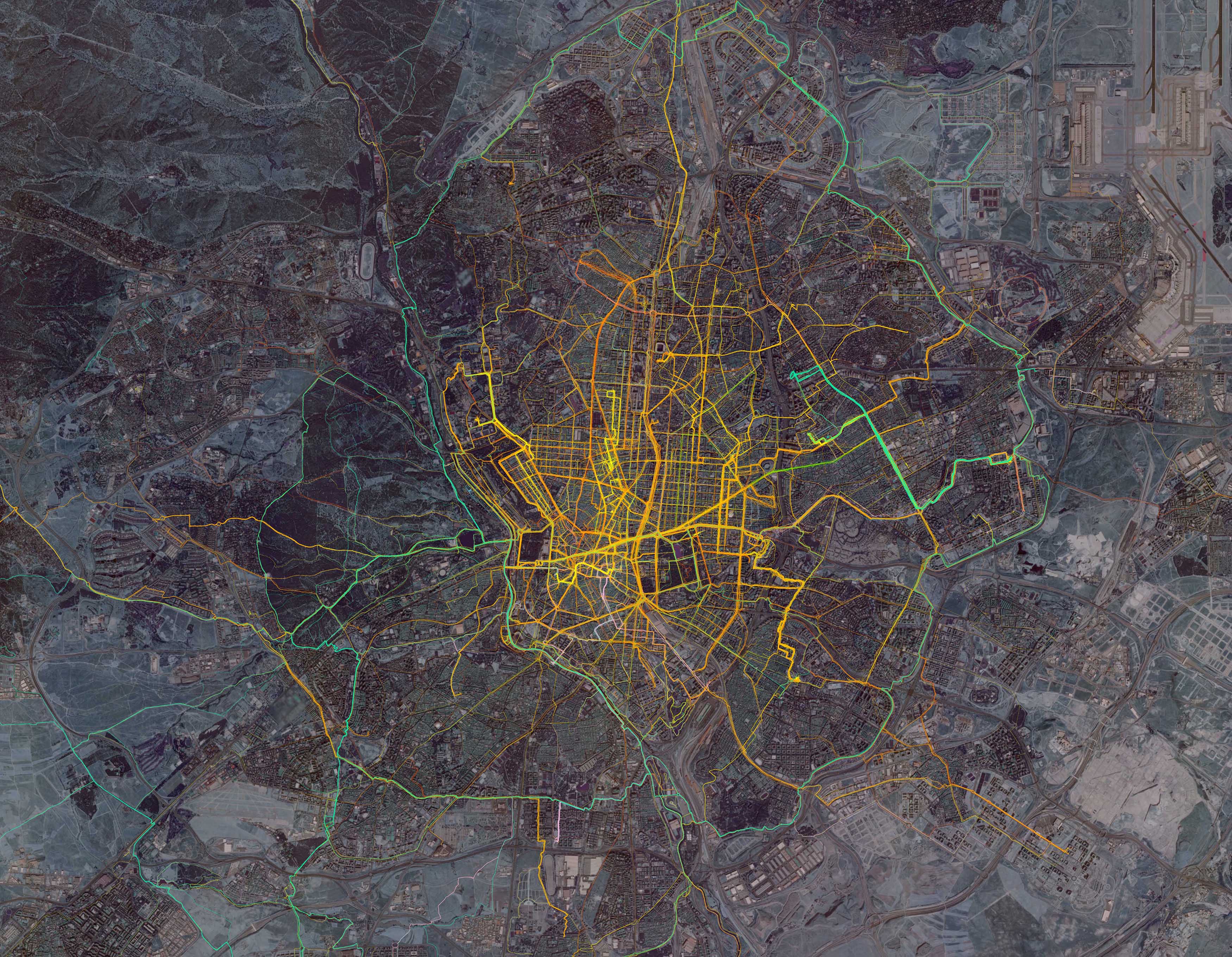
- To visualize cyclists routes in the city of Madrid, considering casual cyclists, bike-messengers and BiciMAD (Madrid Bike-Share System) users.
- To dynamically visualize the distribution of cycling flow, through videos and animations focussed on showing the evolution of cycling activity over time.
- To spatially analyze and model cycling mobility, quantifying the specific impact of variables of different nature: from street-network properties (such as slope, motor traffic average speed, traffic light density, etc.) to properties of the cyclists' journey (purpose of the trip) or variables related to cyclists (such as gender of age).
- To perform a dynamic and comparative analysis of accessibility, evaluating competitiveness between different transport modes.
- To evaluate the impact of different cycling infrastructure or measures.
The results of this research are being disseminated through this website and through a number of academic papers, which can be found in the publication section. Madrid Cycle Track is the core of the research developed by Gustavo Romanillos, also published in his thesis dissertation:The digital footprint of the cycling city: GPS cycle routes visualization and analysis.