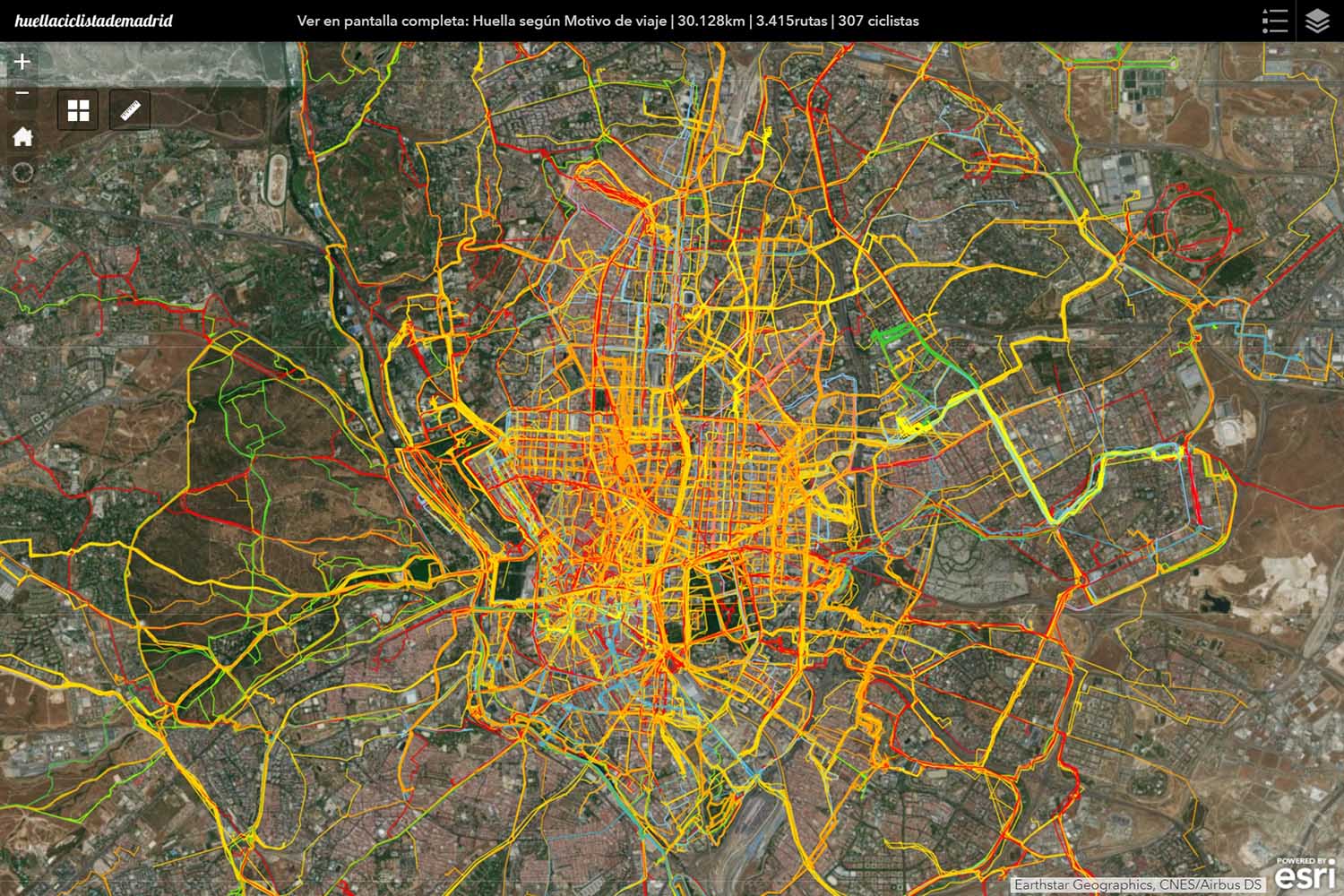
Casual Cyclists Online Map
Explore this map and visualize over 30,000 km of casual cyclists' routes, represented according to the purpose of the journey. The map also offer additional information about each route, such as the average speed, length, duration, as well as information about the cyclists, such as age or gender.
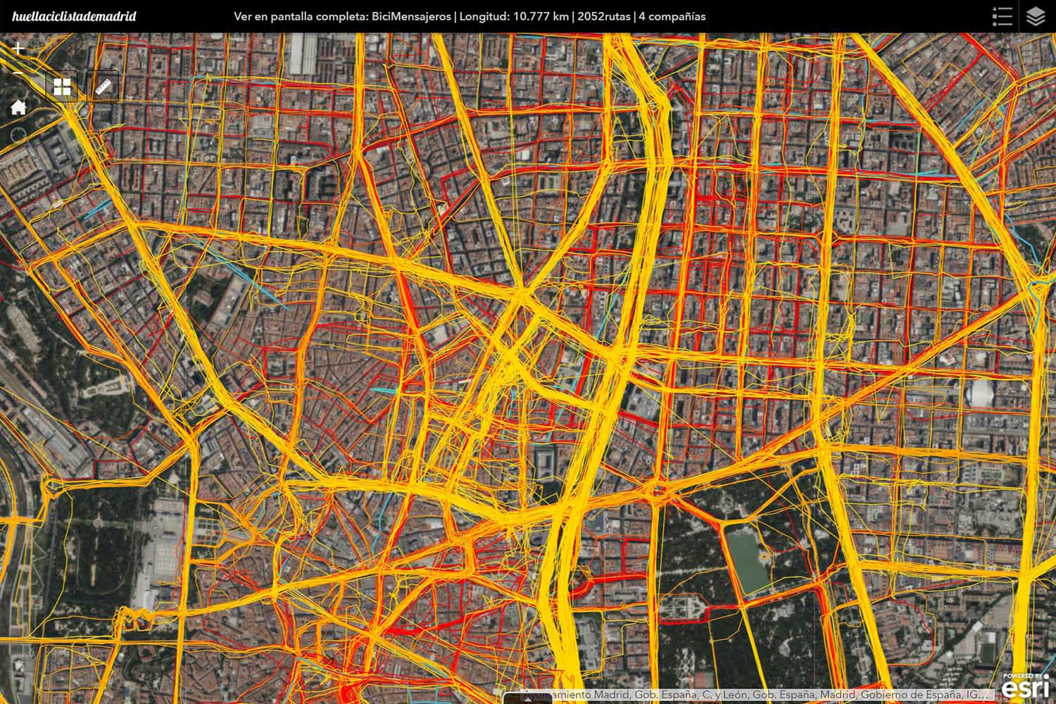
Bike-messengers Online Map
Online Map representing over 10,500 km of bike-messengers' routes in the city of Madrid, collected from four different companies, offering information about each route, such as the type of bike used by the messenger (regular bikes, bullit-cargo bikes or cargo-tricycles), as well as average speed, duration and length of the journey.
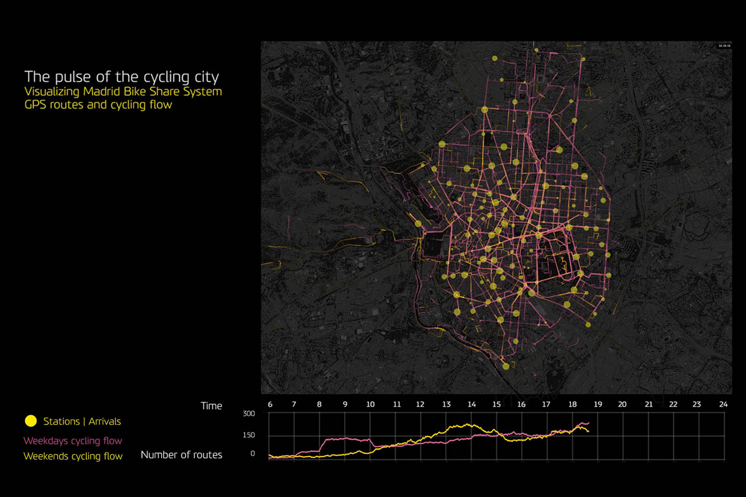
Visualization of BiciMAD cycling flow
This video visualizes the cycling flow derived from BiciMAD (Madrid Bike-Share System) activity over the course of a day, including the routes of both a typical weekday and a typical weekend day. The video illustrates cycling flow in relation to the level of activity of BiciMAD stations.
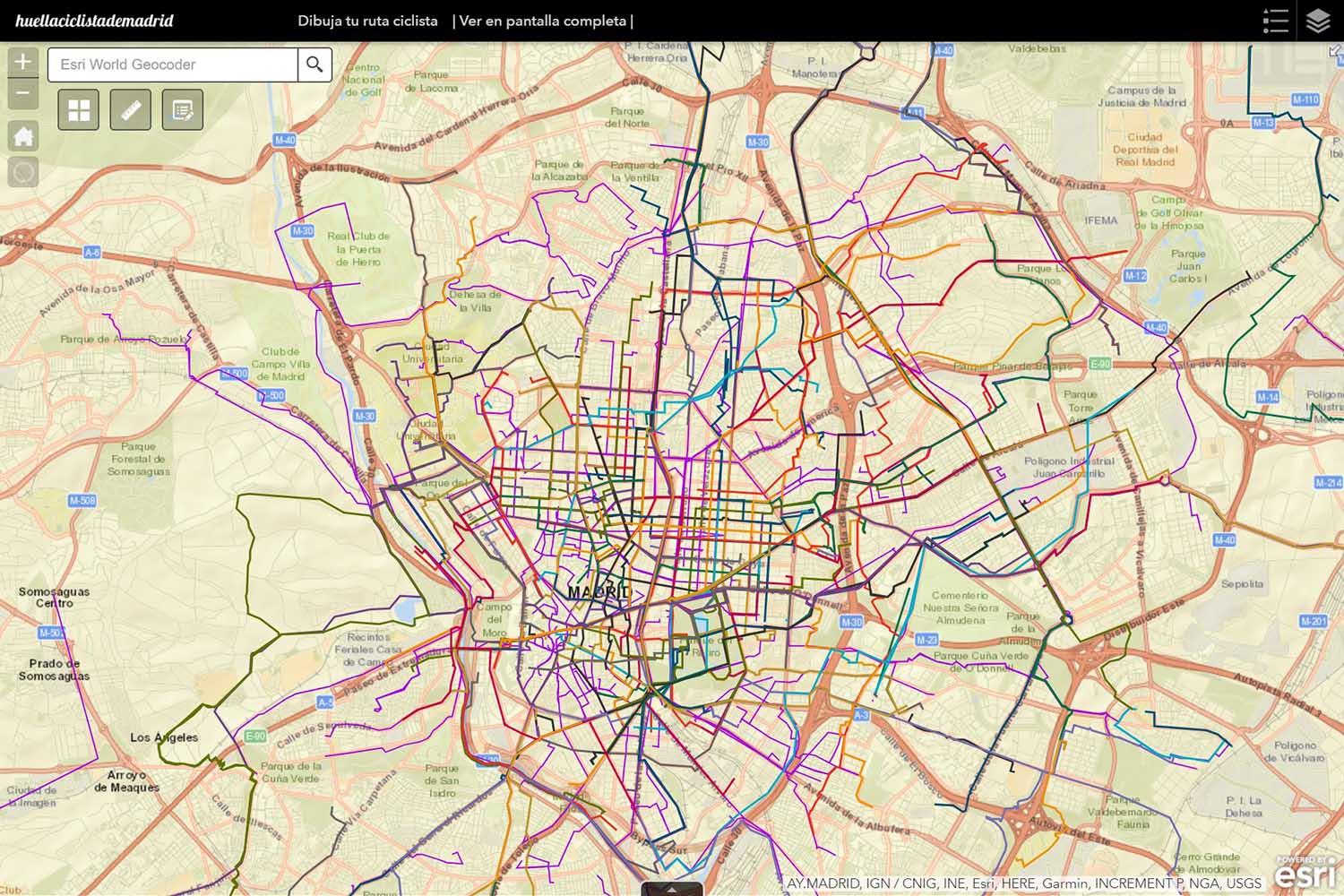
Draw your route! Application
MadridCycleTrack initiative essentially collects GPS routes from cyclists. However, in order to facilitate volunteer participation, it is also possible to draw your route through this user-friendly online application. Once you finish, a pop-up window will ask you to introduce information about your route, which will be considered with research purposes.
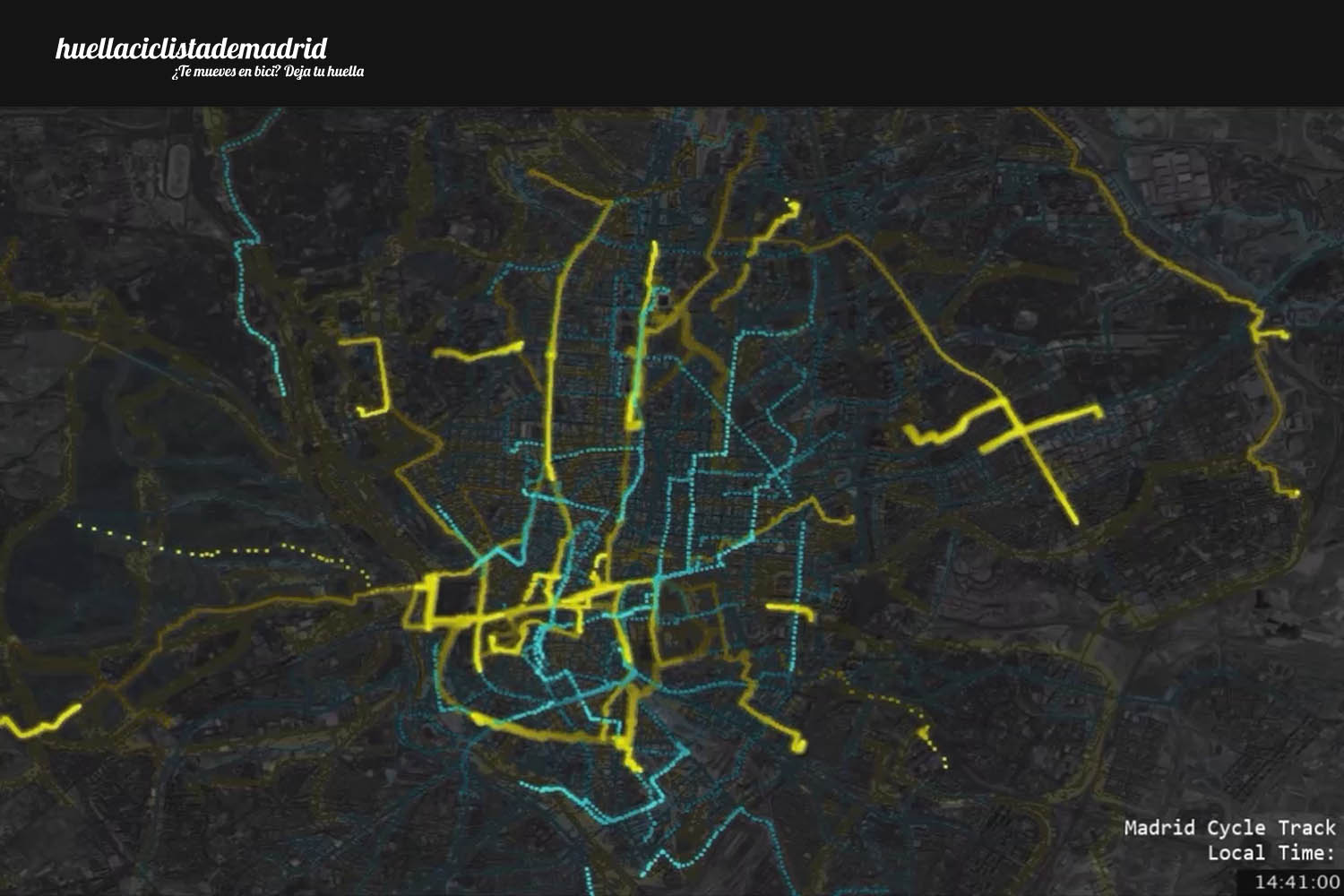
Visualization of Casual Cyclists and Bike-messengers' cycling flow
This video represents casual cyclists and bike-messengers' routes over the course of a typical day. The visualization illustrates the different peaks of activity of both groups, and th complementary temporal patterns of their cycling activity.

Madrid Cycle Track promotional video
This video introduces Madrid Cycle Track, with the aim of disseminating the initiative between cyclists and other people that might be interested in the results. The video show the participation process, from the use of the GPS apps to the visualization of the collective cyclists' footprint.